Datei:Arctic topography.jpg: Unterschied zwischen den Versionen
Aus Klimawandel
(Topographische Karte der Arktis ==Lizenzhinweis== {| style="border:1px solid #8888aa; background-color:#f7f8ff;padding:5px;font-size:95%;" | Quelle: Flickr: Arctic, topography and bathymetry (topographic map), https://www.flickr.com/photos/gridarendal/…) |
K (→Lizenzhinweis) |
||
| Zeile 3: | Zeile 3: | ||
{| style="border:1px solid #8888aa; background-color:#f7f8ff;padding:5px;font-size:95%;" | {| style="border:1px solid #8888aa; background-color:#f7f8ff;padding:5px;font-size:95%;" | ||
| | | | ||
Quelle: Flickr: | Quelle: Flickr: [https://www.flickr.com/photos/gridarendal/32317723846/in/photostream/ Arctic, topography and bathymetry] (topographic map), ursprgl.: Grid Arendal, http://www.grida.no/resources/7738<br /> | ||
Lizenz: | Lizenz: [https://creativecommons.org/licenses/by-nc-sa/2.0/ CC BY-NC-SA] | ||
|} | |} | ||
Aktuelle Version vom 18. März 2019, 21:10 Uhr
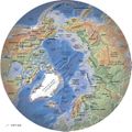
Topographische Karte der Arktis
Lizenzhinweis
|
Quelle: Flickr: Arctic, topography and bathymetry (topographic map), ursprgl.: Grid Arendal, http://www.grida.no/resources/7738 |
Dateiversionen
Klicken Sie auf einen Zeitpunkt, um diese Version zu laden.
| Version vom | Vorschaubild | Maße | Benutzer | Kommentar | |
|---|---|---|---|---|---|
| aktuell | 21:09, 18. Mär. 2019 |  | 550 × 549 (70 KB) | Dieter Kasang (Diskussion | Beiträge) | Topographische Karte der Arktis ==Lizenzhinweis== {| style="border:1px solid #8888aa; background-color:#f7f8ff;padding:5px;font-size:95%;" | Quelle: Flickr: Arctic, topography and bathymetry (topographic map), https://www.flickr.com/photos/gridarendal/… |
Sie können diese Datei nicht überschreiben.
Dateiverwendung
Die folgende Seite verwendet diese Datei: