Datei:Nordsee Tiefe.jpg
Aus Klimawandel
Größe dieser Vorschau: 800 × 524 Pixel. Weitere Auflösung: 880 × 576 Pixel.
Originaldatei (880 × 576 Pixel, Dateigröße: 199 KB, MIME-Typ: image/jpeg)
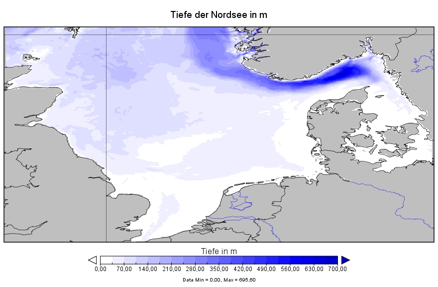
Tiefenkarte der Nordsee
Lizenzhinweis
|
geplottet mit Panoply, Datenquelle: Mathis, M, and T. Pohlmann (2014): Projection of physical conditions in the North Sea for the 21st century. Climate Research 61, 1–17 |
Dateiversionen
Klicken Sie auf einen Zeitpunkt, um diese Version zu laden.
| Version vom | Vorschaubild | Maße | Benutzer | Kommentar | |
|---|---|---|---|---|---|
| aktuell | 22:41, 7. Feb. 2017 | | 880 × 576 (199 KB) | Dieter Kasang (Diskussion | Beiträge) | Tiefenkarte der Nordsee ==Lizenzhinweis== {| style="border:1px solid #8888aa; background-color:#f7f8ff;padding:5px;font-size:95%;" | geplottet mit Panoply, Datenquelle: Mathis, M, and T. Pohlmann (2014): Projection of physical conditions in the North… |
Sie können diese Datei nicht überschreiben.
Dateiverwendung
Die folgende Seite verwendet diese Datei: