Datei:Alpen Lage Höhe.jpg
Aus Klimawandel
Größe dieser Vorschau: 800 × 459 Pixel. Weitere Auflösung: 834 × 479 Pixel.
Originaldatei (834 × 479 Pixel, Dateigröße: 100 KB, MIME-Typ: image/jpeg)
Beschreibung
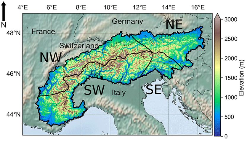
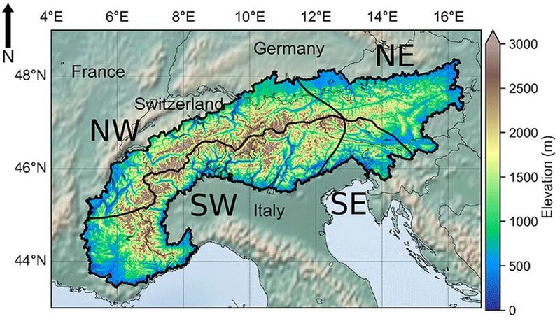
Lage, Einteilung und Höhenkarte der Alpen
Lizenzhinweis
|
Quelle: Monteiro, D. and S. Morin (2023): Multi-decadal analysis of past winter temperature, precipitation and snow cover data in the European Alps from reanalyses, climate models and observational datasets, The Cryosphere, 17, 3617–3660 |
Dateiversionen
Klicken Sie auf einen Zeitpunkt, um diese Version zu laden.
| Version vom | Vorschaubild | Maße | Benutzer | Kommentar | |
|---|---|---|---|---|---|
| aktuell | 15:26, 26. Sep. 2023 | | 834 × 479 (100 KB) | Dieter Kasang (Diskussion | Beiträge) | Lage, Einteilung und Höhenkarte der Alpen == Lizenzhinweis == {| style="border:1px solid #8888aa; background-color:#f7f8ff;padding:5px;font-size:95%;" | Quelle: Monteiro, D. and S. Morin (2023): Multi-decadal analysis of past winter temperature, precipitation and snow cover data in the European Alps from reanalyses, climate models and observational datasets, The Cryosphere, 17, 3617–3660, https://doi.org/10.5194/tc-17-3617-2023<br> Lizenz: CC BY 4.0 |} |
Sie können diese Datei nicht überschreiben.
Dateiverwendung
Die folgende Seite verwendet diese Datei: